

Discipline:
Aerial Drone Survey
Location:
Newport
Client:
Redrow Homes South Wales
Sector:
Residential
Phase:
Multi Phase
Size:
3 hectares
Background
T&P Regeneration was commissioned by Redrow Homes South Wales to undertake an aerial drone survey of the School and Village Centre sites within the Great Milton Park development at Llanwern. The client required a reliable digital representation of existing ground conditions to support the extraction of level and stockpile information for use within their design and engineering workflows.
Objectives
The objective of the project was to capture accurate aerial survey data across the School and Village Centre areas. The survey was intended to generate reliable site level information and digital terrain data that could be extracted and delivered in DWG format. These outputs would provide the client with clear and accessible ground level data to support design development and engineering assessment.
Scope of Works
The works began with pre-flight planning and preparation of all required health and safety documentation. A Civil Aviation Authority (CAA) trained pilot attended site to carry out the aerial drone survey across the School and Village Centre areas. Temporary ground control points were established to support the geolocation accuracy of the captured imagery and survey data.
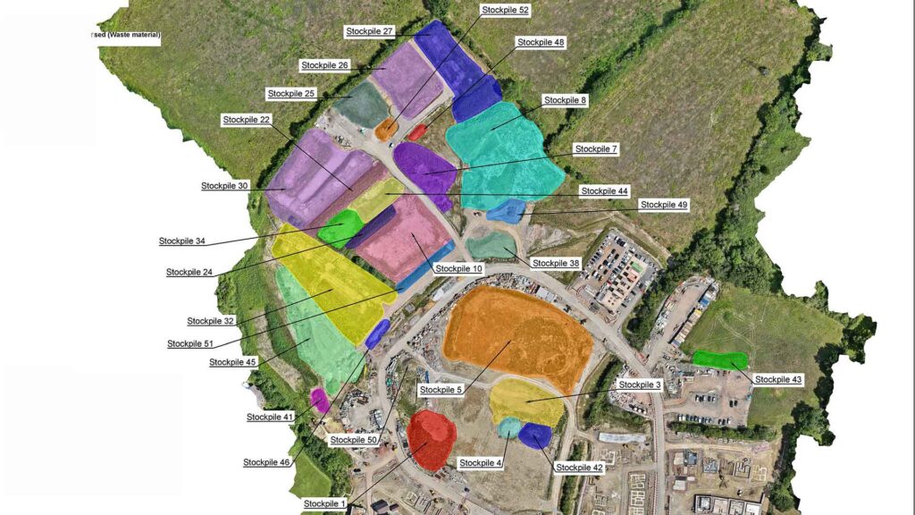
The captured data was processed to produce a digital terrain model and a 3D representation of the existing ground surface. Survey outputs were provided through a web-hosted platform. The primary objective of these surveys was to obtain accurate stockpile volume calculations to support internal planning and operational decision-making.
Outcome
The aerial survey provided Redrow Homes South Wales with a clear and accurate digital representation of the School and Village Centre areas within the Great Milton Park development. The processed survey data delivered reliable ground level information as well as quantified stockpile volumes that could be accessed through a web-hosted platform and integrated directly into the client’s design and engineering workflows.
By providing precise site level volumetric data in both web and CAD-ready outputs, the survey enabled the project to review existing ground conditions, stockpile measurements with confidence. The results helped support efficient planning and informed decision making for the next stages of the development
Category: