

Discipline:
Aerial Survey and Cut & Fill
Location:
Stroud, Gloucestershire
Client:
Newland Homes Ltd
Sector:
Residential
Phase:
Single Phase
Size:
3.2 hectares
Background
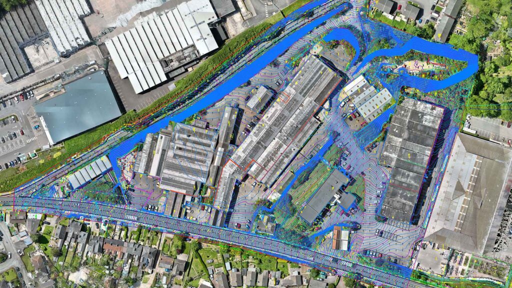
T&P Regeneration was appointed by Newland Homes Ltd to support the redevelopment of Daniel’s Industrial Estate in Stroud, where a former commercial and industrial site was being transformed into a residential-led scheme. Due to the site’s scale, varied topography, and existing stockpiles, conventional survey methods would have been slow and potentially disruptive. To aid design, planning, and overall site management, Newland Homes required a fast, accurate aerial survey capable of delivering both detailed technical modelling data and high-quality visual material for project stakeholders.
Objectives
The project aimed to capture a high-quality aerial survey that would generate accurate digital terrain models, 3D site visualisations, and geolocated imagery. The outputs were intended to inform design development, track cut and fill requirements, and provide clear data for site management. In addition, the survey sought to offer volumetric insights into stockpiles and generate outputs that could be adapted for marketing purposes, ensuring that the data delivered value across technical, operational, and commercial functions.
Scope of Works
The works began with the preparation of a site-specific flight plan, including all necessary permissions and health and safety documentation. Temporary ground control points were established to ensure the geolocation accuracy of the drone data. The site was then surveyed using drone technology over two separate flights, capturing coverage of the full 4 – 6 hectare area.
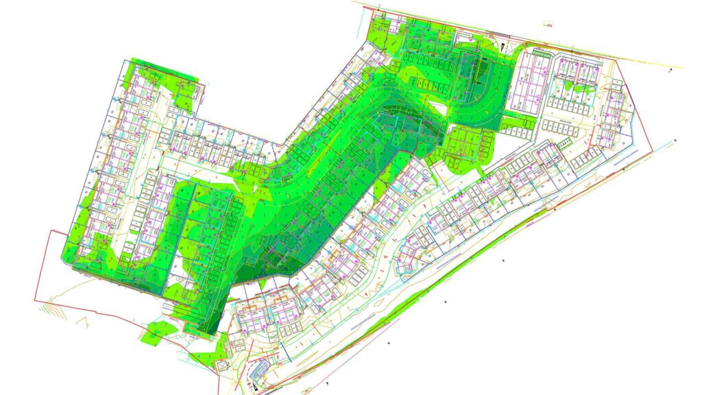
The captured data was processed into a 3D model and a digital terrain model, both provided in CAD-ready formats with spot levels and contour information. The modelling process was carried out by an experienced engineer to ensure accuracy and usability of outputs. Additional options, including stockpile volumetrics, cut and fill tracking drawings, and specialist marketing imagery, were made available to maximise the value of the dataset.
Outcomes
The aerial survey gave Newland Homes a highly accurate digital representation of the site, including 3D models, detailed topographic information, and terrain data that were seamlessly integrated into the design process. These outputs enabled precise planning of site levels, efficient material management, and a clearer understanding of stockpile volumes. The high-quality imagery also proved valuable for communicating progress and future vision to both internal teams and external stakeholders.
T&P Regeneration successfully delivered a tailored aerial survey and modelling package that addressed the technical and operational requirements of the redevelopment. By combining CAD-ready models, volumetric data, and visually engaging outputs, the project equipped Newland Homes with the tools to plan, manage, and showcase the scheme with confidence. The work highlighted the efficiency, accuracy, and flexibility that aerial surveying brought to a complex redevelopment project of this scale.
Category: