

Discipline:
As-Built Aerial Survey
Location:
Swindon
Client:
Redrow Homes South West
Sector:
Residential
Phase:
Post Construction
Size:
61 Hectare
Background
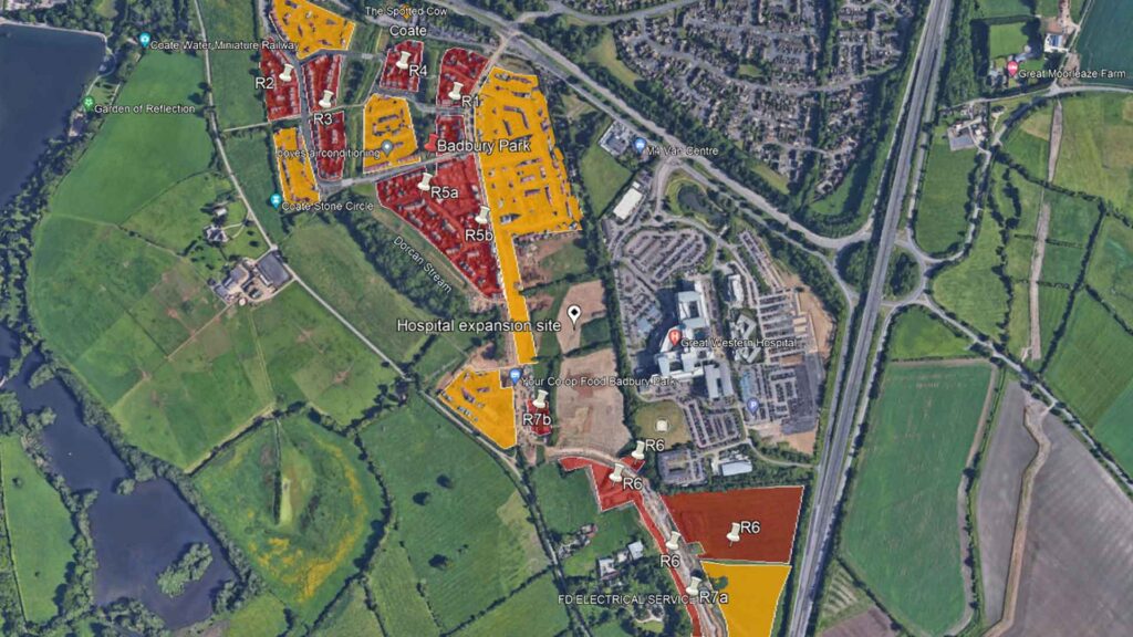
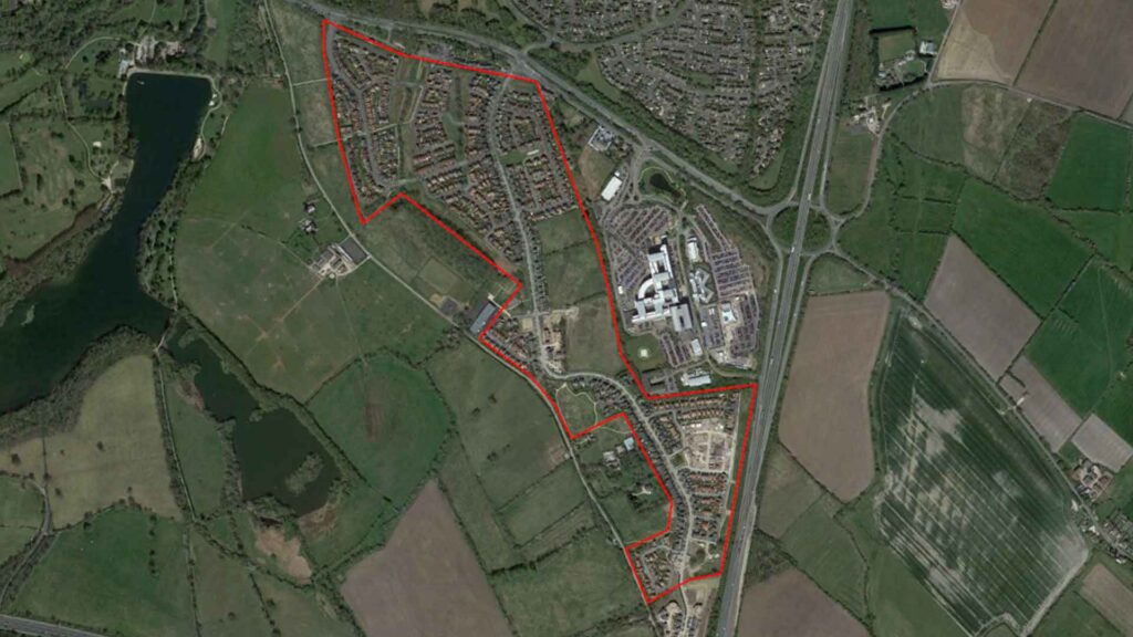
T&P Regeneration was appointed by Redrow Homes South West to undertake an aerial survey at Badbury Park, Swindon. The survey was required to capture accurate as-built levels and site features across the defined survey area. As much of the development was already occupied, the works required careful planning and advance communication with residents to ensure the drone survey could be completed safely and in accordance with operational requirements.
Objectives
The objective of the project was to undertake an aerial survey to capture accurate as-built levels and site features across the Badbury Park development. The survey was intended to provide a comprehensive digital record of the site, enabling reliable access to spatial data and supporting ongoing site management without the need for repeated site visits.
Scope of Works
T&P Regeneration undertook pre-flight planning and prepared the necessary health and safety documentation prior to completing the aerial survey. The survey was carried out by a Civil Aviation Authority (CAA) trained pilot to capture high-resolution aerial imagery and accurate as-built data across the defined survey area. Following completion of the survey, T&P Regeneration processed and delivered a suite of digital outputs, including orthogonally corrected 4K aerial imagery, a 2.5D Digital Elevation Model (DEM), a 3D polygon model and web-hosted survey data. The cloud-based platform enabled the client to remotely view the survey and compare the as-built development against the proposed development layout and levels. The clouds ability to overlay CAD drawings provided a quick and efficient way to check compliance across the site.
Outcome
The aerial survey provided Redrow Homes South West with an accurate, high-resolution digital record of the completed development, enabling efficient access to as-built site information through a secure cloud-based platform. The comprehensive survey outputs allowed the client to remotely access site data, take measurements and overlay CAD drawings to efficiently compare the completed development against proposed design layouts and levels. The result was a detailed digital record of the development that can be used to clearly demonstrate design compliance and rapidly highlight any areas of potential concern for future consideration to facilitate prioritised remedial actions if required.
Category: