


Discipline:
Laser Scanning & 3D Modelling
Location:
Trinity Road, Bristol
Client:
The Hill Group
Sector:
Residential
Phase:
Single Phase
Size:
Circa 6,600m²+
Background
The Hill Group is undertaking the redevelopment of a large urban site at Trinity Road in Bristol. With a total floor area of 6,684m² requiring accurate assessment, the client needed precise data to validate floor levels and ensure alignment with design specifications and regulatory requirements. Traditional surveying methods would have been labour-intensive and time-consuming across such a large and complex footprint. To meet programme and accuracy requirements, The Hill Group sought a specialist solution that could deliver rapid, reliable results.
Objectives
The project aimed to capture accurate floor level data across the newly constructed floor slabs to support design validation and construction progress monitoring. The outputs were required to be highly precise, formatted for integration with design workflows, and delivered within tight time frames to avoid delays to the wider programme. The solution also needed to provide efficiency in delivery while minimising disruption to site activities.
Scope of Works
The survey was conducted using advanced laser scanning technology integrated with 3D modelling techniques adapted from aerial surveying software. A sequence of laser scans captured high-resolution imagery and detailed floor level data across the entire site. Temporary survey control points were established to ensure precise accuracy, and multiple site visits were carried out to achieve complete coverage of all required areas.
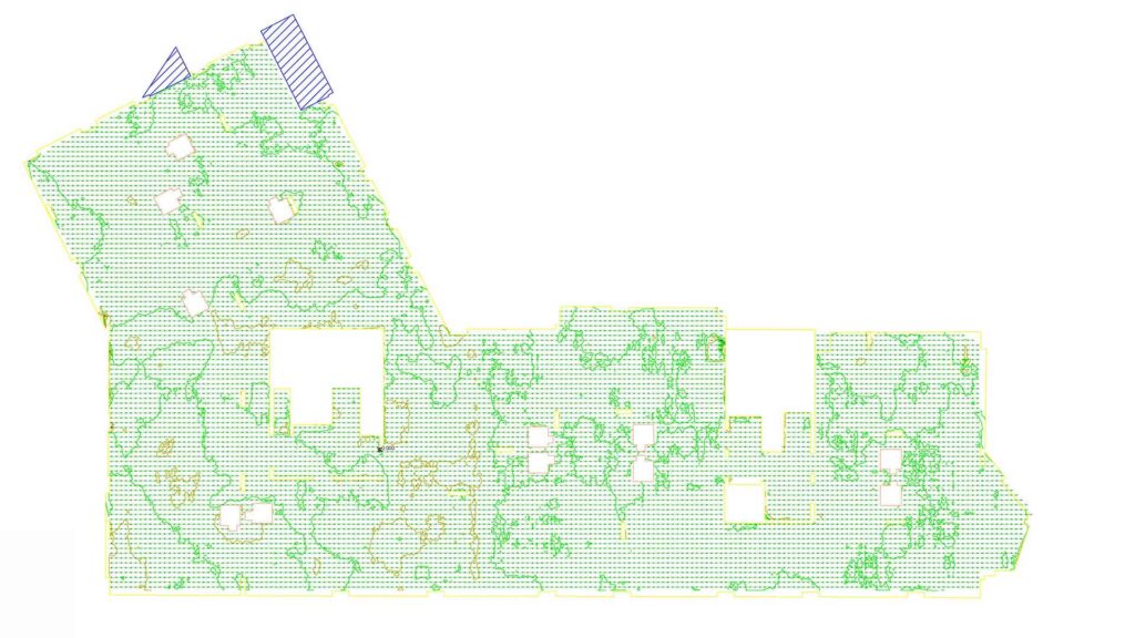
The captured data was processed into a detailed floor level survey, providing clear and reliable measurements. The processing methodology ensured that all outputs were precise, consistent, and directly usable by The Hill Group’s design and engineering teams. By adopting this approach, the survey was delivered more quickly and with greater coverage and precision. The data was processed and presented in a way that clearly and accurately highlights low areas within the reinforced concrete floor levels, ensuring they fall within NHBC allowable tolerances. These Isopach-style outputs align with NHBC standards and help identify areas where the floor may require cutting back or filling.
Outcome
The survey gave The Hill Group a precise and comprehensive floor level dataset, accurately capturing all three residential blocks. The outputs were delivered in CAD-ready formats that integrated directly into the client’s design workflows, enabling straightforward validation of construction progress and design compliance. The speed of delivery meant that decisions could be made without delay, helping the overall project to remain firmly on schedule.
T&P Regeneration successfully delivered a tailored 3D laser scan survey solution that balanced cost-effectiveness with high technical quality. By combining advanced 3D laser scanning with previous aerial survey and modelling expertise, the team provided accurate, actionable data that reinforced both engineering precision and programme certainty. This project highlighted the clear advantages of laser scanning technology in achieving efficiency, speed, and accuracy on complex urban development sites.
Category: