
Aerial Surveying, Site Investigations & 3D Modelling Services
Accurate site data is the foundation of every successful project. Our Aerial Surveying and 3D Modelling services provide architects, engineers, developers, and site managers with fast, reliable insights to support planning, design, and construction. Using advanced drone technology, our experienced drone surveyors capture high-resolution imagery and precise site measurements, delivering detailed models that improve decision-making while reducing time, costs, and on-site disruption.
Whether you're carrying out Pre-construction Site Investigations, planning a new development, or monitoring project progress, our aerial surveys deliver accurate information that traditional surveying methods can take much longer to collect. Working alongside our geotechnical consultants and environmental contractors, we integrate aerial data with Site Investigation findings to provide a complete understanding of ground conditions and project requirements. From topographic mapping and volumetric calculations to progress monitoring and digital terrain models, our tailored surveying solutions help projects move forward with confidence across Bristol and throughout the UK.
Benefits of aerial surveys
There are many benefits to aerial surveys especially when compared to the traditional method of surveyors on-site with GPS staffs and total stations.
How our aerial survey and 3D modelling service works
When you contact us about an aerial survey, we will first talk to you to understand your site and what you are trying to achieve. During this, we will share what is possible, the costs and answer any questions that you have.
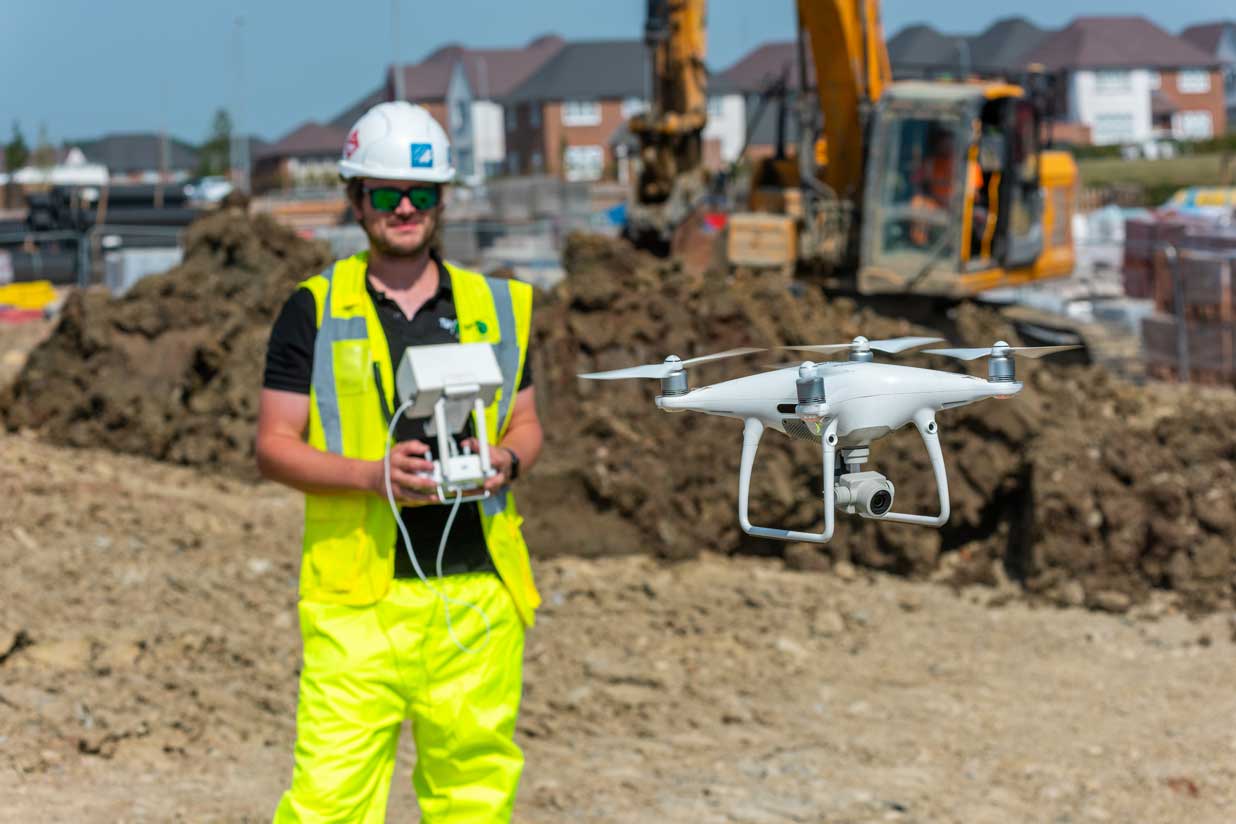
Once you are ready to proceed, we will calculate the flight plans and parameters prior to arrival on site. Our engineers will then go to your location, set themselves up and conduct the aerial survey using our advanced drones which capture a series of high-quality images.
Our expert in-house team will then use the powerful PIX4D software to stitch the images together and create a dense point cloud which is used to generate highly accurate and interrogatable 3D textured meshes, 2D orthomosaic maps and a range of other models. We share these with you through our secure online portal. You can use them yourself for site and project monitoring and present relevant data and images to other stakeholders in your project.
Why choose us for your development site?
It's rare that a geo consultancy offers this 3D modelling and aerial surveying service. It means that rather than simply offering drone experts, our survey teams are led by qualified engineers. They appreciate the bigger picture and are ideally placed to model, interpret and report on captured site data. You get a complete package hard to rival by any other firm.
To find out more, simply call us or send us a message via email or our contact form. We will help you understand how we can assist and answer any questions that you have.
Cherelle Greenaway – DWH

“T&P offer a great comprehensive service, they are very responsive, and reliable.”
John Drew – Barratt Homes
“I would like to thank you for the desk study and ground investigation report. The report together with the advice provided during the tender stage ensured Barratt was fully aware of the abnormal costs associated with developing the site. I look forward to developing our working relationship in the future.”
Anthony Smith – Redrow
“TP Regen have been providing us with invaluable drone survey work and follow expertise around cut and full analysis to inform our material management on site.”
Geoff Burr – Skeletal Consulting Engineers
“We have had a very good experience working with T&P in the past - we appreciate your thorough and thoughtful approach to ground investigations . Your reports are clear and helpfully presented.”
Jeremy Johnson – Wainhomes (Severn Valley) Ltd
“I have always found T&P a dependable and highly proficient company. Mike and his team provide an excellent service, meeting the growing needs of developers in today's market.”
Contact us for more!
Technology moves fast – and drones and 3D digital visualisation techniques are some of the latest advances. Quick… easy… and with greater accuracy guaranteed – discover the benefits of taking to the skies. Connect with us to find out more.
Frequently Asked Questions
Businesses we work with